

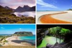
If you are planning a trip to Tasmania, chances are you’ve heard about Tarkine Drive, in the north-west of the state. It is one of the most beautiful natural destinations in Tasmania that still manages to stay largely under the tourist radar. This guide provides all the information you need for planning your Tarkine Drive adventure, including all the main attractions and accommodation options.
Tarkine Wilderness
Tucked away in the north-west corner of Tasmania, Tarkine Wilderness is the largest expanse of temperate rainforest remaining in Australia and the second largest in the world. It is a world of pristine rainforests, wild rivers, rugged coastlines, and abundant wildlife.
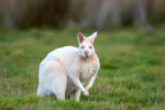
In the 1930s Tarkine wilderness was considered to be the last refuge of the now extinct Tasmanian Tiger. Today, the iconic marsupial remains in the Tarkine only in name – Kanunnah Bridge Picnic Area takes its name from the Aboriginal name for Tasmanian Tiger.
A significant portion of the 477,000 hectare Tarkine wilderness is protected by reserves and national parks but the proposal to designate the entire area as Tarkine National Park has been caught in legislative debates since 2011.
In the meantime, parts of the Tarkine forest are open for logging. It is a devastating realization since these ancient trees are literally irreplaceable, in our human time frames at any rate.
This is why the organizations that certify timber products for the market, like the Forest Stewardship Council and WWF, never certify practices involved in logging of the old-growth forests. So Tasmanian timber is not appealing to the international buyers and the logging industry in Tasmania is running at a loss.
Tarkine Drive
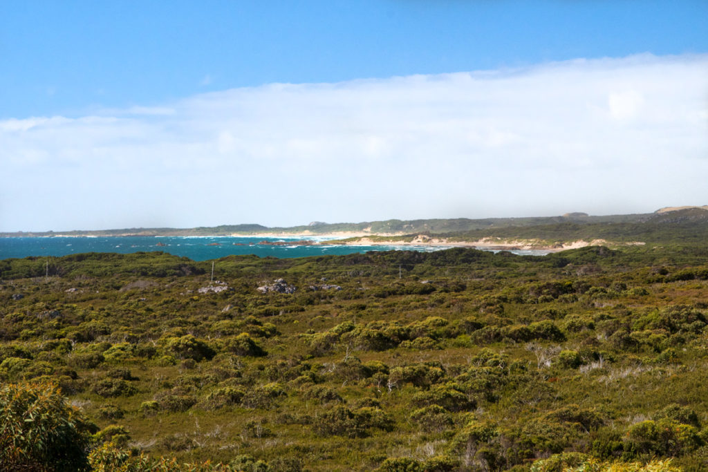
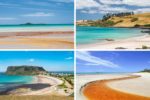
The stunning and dramatic Tarkine Drive is a series of sealed roads that give you an opportunity to experience the Tarkine wilderness via a series of scenic lookouts and short walking trails. It takes you to flooded limestone sinkholes, fairytale-like mossy rainforest, rugged coastline, and even to the edge of the world.
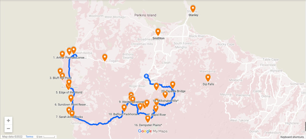
Starting and finishing in Smithton, Tarkine Drive can be taken in either clockwise or counterclockwise direction. The entire loop from Smithton is just over 190 kilometres.
There are two distinct sections of the drive: Tarkine Rainforest and Tarkine Coast. If you wish to start exploring the rainforest section first, head for Trowutta Arch from Smithton. And if you wish to drive the coastal section first, set your navigation for West Point State Reserve.
How many days to spend on Tarkine Drive?
You could do the entire drive in about 3 hours if you wanted to. But most of the attractions of Tarkine Drive are located off the main road, so you would miss most of them by just driving through.
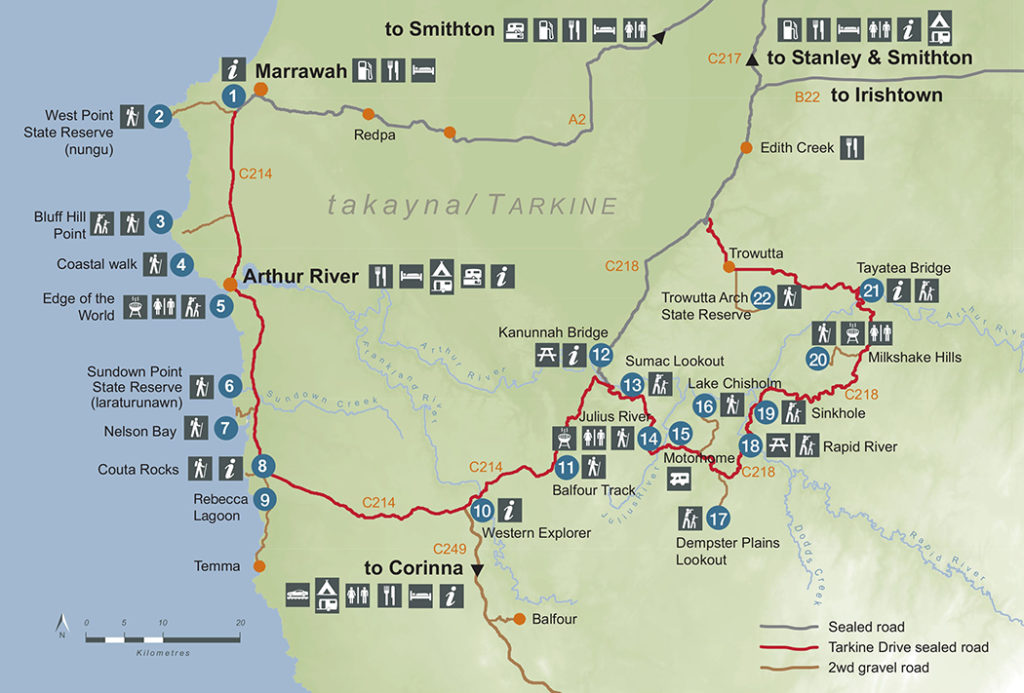
There are 21 points of interest marked on the official Tarkine Drive brochure (see the tourist map below). Some of them are lookouts that are located close to the main road, others are accessed by gravel roads, and some are walking trails from 15 min to 3 hours.
Depending on how many of the walks you’d like to take, you can comfortably explore Tarkine Drive in 2 days. This is what my friend Anu and I did, and we had enough time to visit the vast majority of attractions and do most of the shorter trails.
We took the drive in a counterclockwise direction, leaving Stanley in the morning and spending day 1 exploring the rainforest section of the drive. Overnight we stayed in a cozy Tarkine Grove Cottage – located on farmland adjacent to the Tarkine rainforest. On day 2 we explored the coastal section of the drive and returned to Stanley for the night.
Know Before You Go
If you are looking for inspiration, rather than the practical details, skip straight to Tarkine Drive Attractions.
Fuel and Groceries
Most of the Tarkine Drive travellers through remote areas and there are no supermarkets or gas stations anywhere on the drive. There is only a small shop in Arthur River that has some canned goods and offers takeaway, but it doesn’t sell petrol. We definitely recommend fueling up and stocking up on the groceries in Smithton.
If you decide to stay at Tarkine Grove cottage, you’ll have a fantastic walk-in pantry and all the necessary cooking utensils. Most Arthur River holiday homes also have well-stocked kitchens.
Road Conditions
Most of the roads on Tarkine Drive are sealed. There are a few gravel access roads at some of the points of interest, but they are generally in good condition perfectly suitable for a sedan.
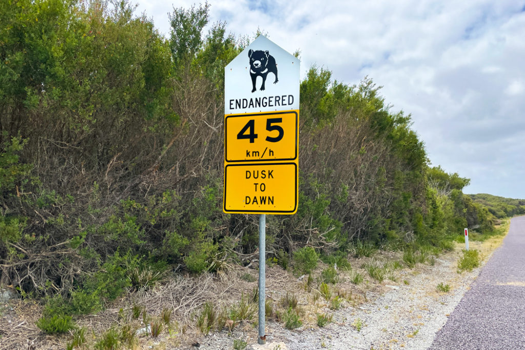
The stark exception from this rule is the 3.7 km section of Sumac road that leads from Rapid River road (the main road) to Dempster Plains Lookout (#17 on the tourist map below). This road is not suitable for low-clearance cars. It is pockmarked with giant potholes and there are tree trunks sticking out from the sides of the road. There are no signs on the main road to warn drivers about the condition of the road ahead, and once you are committed, there are no opportunities to turn around safely.
You’ll have no problem on this road in a high-clearance vehicle. But be very cautious about taking a sedan down this way, especially considering that there is no mobile reception in this area. So if you get stuck, you’ll have to wait for someone to come by, which could be the whole day.
Mobile reception is quite patchy on parts of Tarkine Drive and practically absent on the rainforest section. If you like using Google maps for navigation, you may like to download offline maps in advance (you can find instructions here).
Generally, Telstra did the best job of finding network connectivity, while Vodafone remained offline practically the entire drive.
Tarkine Drive Map
Stanley Visitor Center’s website provides some useful information about the drive. You can download the official Tarkine Drive brochure as well as a Tourist Map and Interactive Map. The interactive map is particularly handy, as most of the attractions are not marked on Google maps.
Most of the stops are signposted quite well, so you can certainly get away with just the tourist map. The only locations we nearly missed were the Sinkhole in the rainforest section and Bluff Hill Point on the coast.
Driving Times and Distances
| Smithton | Trowutta Arch | 31 km | 30 min |
| Trowutta Arch | Milkshake Hills | 26 km | 30 min |
| Milkshake Hills | Dempster Plains | 32 km | 35 min |
| Dempster Plains | Lake Chisholm | 11 km | 15 min |
| Lake Chisholm | Julius River | 8 km | 10 min |
| Julius River | Sumac Lookout | 8 km | 10 min |
| Sumac Lookout | Balfour Track | 6 km | 10 min |
| Balfour Track | Couta Rocks | 29 km | 30 min |
| Couta Rocks | Arthur River | 15 km | 15 min |
| Arthur River | West Point | 17 km | 17 min |
| West Point | Smithton | 54 km | 44 min |
| Smithton | Stanley | 21.6 km | 20 min |
| Smithton | Launceston | 231 km | 2.5 hrs |
Tarkine Drive Accommodation
Technically Smithton is the closest town to Tarkine Drive that has a wide range of accommodation options. But if you are going to stay in town, we recommend staying at Stanley instead. it’s only a 20-min drive away and it is a much more beautiful town. You can check out this post for accommodation options and things to do in Stanley. I promise you will fall in love with this gorgeous historic town surrounded by the ocean.
If you would like to stay on the Tarkine Drive itself, your choices are Rodger River (rainforest section) and Arthur River (coastal section).
Rodger River
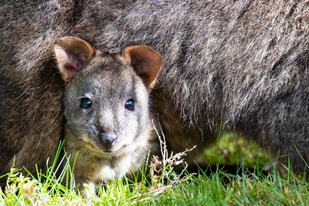
At Rodger River, you can stay at the cozy Tarkine Grove cottage. It is located on farmland adjacent to the rainforest. The cottage has two bedrooms, an amazingly well-stocked kitchen, laundry facilities and it offers some fantastic wildlife spotting opportunities, including the platypus, Tasmanian devil, Spotted-tailed quoll, and of course, Tasmanian pademelon.
Arthur River
The small township of Arthur River lies at the most western point of the island of Tasmania. It is a convenient base if you are planning to take the Arthur River cruise. There are a few accommodation options in town, but they do book out quickly, so it’s best to book well in advance. Check out the units at Sunset Holiday Villas, and a few different apartments at Arthur River Lodge: Upstream apartment, Downstream apartment, or Entire House.
Motohome Site at Julius River
There is a designated area for motorhomes at the Julius River Motorhome Site just a couple of minutes drive from Julius River Forest Reserve.
Camping on Tarkine Drive
Most designated campsites are located around the township of Arthur River. There are three serviced campsites: Manuka and Peppermint both have water on-site and are located close to the Parks and Wildlife Visitor Centre on Arthur River Road. Prickly Wattle campsite can be found approximately 1 kilometre south of Arthur River, on Temma Road. For more details check Tasmania Parks and Wildlife Service website.
Amenities on the Tarkine Drive
There are very few toilets and absolutely no rubbish bins on Tarkine Drive. So you’ll need to plan your toilet visits in advance and bring your own rubbish bag to keep in the car. The toilets are available at Milkshake Hills, Julius River, and the Edge of the World.
Tarkine Drive Unmissalbe Highlights
The Tarkine Drive is made up of highlights. Every stop has something unique to offer. But if you are short on time and can only visit a few points of interest, here are the best of the best
- Trowuttah Arch – A flooded limestone sinkhole, or a cenote – a rare and dramatic geological feature
- Lake Chisholm– A stunning section of rainforest with enormous trees and a large sinkhole
- Sumac Lookout – A sweeping view over Tarkine rainforest and Arthur River
- Balfour Packhorse Track – A wild section of thick rainforest filled with moss and fungi.
- Edge of the World – An epic view of the Tarkine coast
Tarkine Drive 2-Day Itinerary
Now that we’ve covered the basics, it’s time to take the journey into Tarkine Wilderness. The tourist map of Tarkine Drive provides the perfect blueprint for your road trip itinerary. We simply followed the map from one stop to the next.
Trowuttah Arch State Reserve
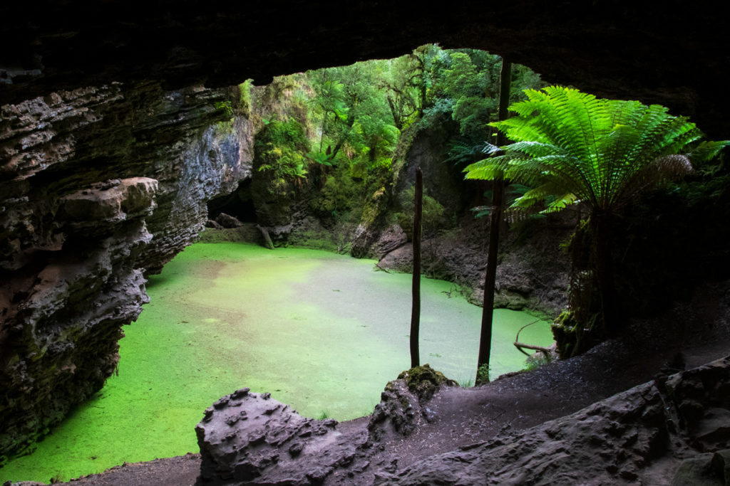
The first attraction on Tarkine drive, the Trowutta Arch, is one of the best examples of a water-filled sinkhole, or a cenote, in Tasmania.
It is accessible via a 5-km gravel road and a 1.1-km walking trail through the beautiful lush rainforest. The turn-off to the arch is well signposted and the road is in good condition. We had no issues driving it in our rental Corolla.
The walking trail starts at the car park and immediately ducks into the cool rainforest filled with tree ferns and moss-covered tree trunks. At the end of the trail, you come to a large limestone arch with a bright green body of water visible through it. It is this green algae-covered surface of the sinkhole set against the dark rocks that make Trowutta Arch so striking.
There are actually two sinkholes at this location and you can reach the second one by a short scramble under the arch to your right. But the second sinkhole is brown-coloured and nowhere near as atmospheric.
Another amazing thing about the Trowutta Arch cenote is that it’s 20 meters deep! That’s because a sinkhole starts its life as an underground cavern filled with water. It then grows until the ceiling of the cavern collapses and exposes it. You can read about it on the interpretive signs along the trail. It is a really interesting site. And there is a chance to spot some Tasmanian pademelons along the trail.
Tayatea Bridge
Tayatea is the first of three bridges over the wild rivers of Tarkine. This one crosses the Arthur River. You can park next to the bridge and walk across it to watch the river as it flows through the Tarkine rainforest.
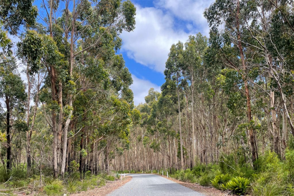
Milkshake Hills
Milkshake Hills is where you really start seeing the Tarkine rainforest. The access road is another 5km gravel road in very good condition for a sedan. The picnic area next to the car park has toilets, BBQ facilities, and some tables and benches. It’s a good spot to have your packed lunch.
There are two walking trails at Milkshake Hills: the 15-min Forest Walk and a 1-hr Summit Lookout. The summit walk takes you past the pretty buttongrass moorlands to a lookout with sweeping views of the Tarkine rainforest.
But we preferred the forest trail. While it’s very short, the wet eucalypt forest here is gorgeous. The light filtering through the canopy is quite dim, and practically every surface in the forest is covered with a thick blanket of moss. This is your first taste of the Tarkine rainforest and it is breathtaking.
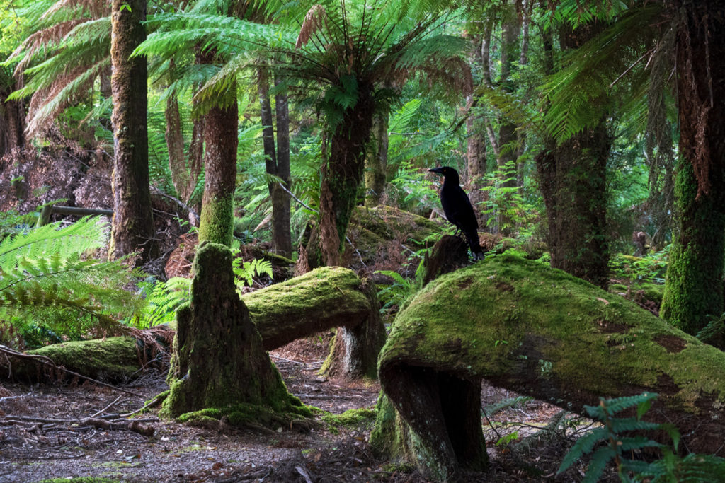
While we had our lunch, we were joined by a curious Black currawong – one of Tasmania’s 12 endemic bird species. It looked quite at home sitting on a moss-covered tree stump.
Sinkhole
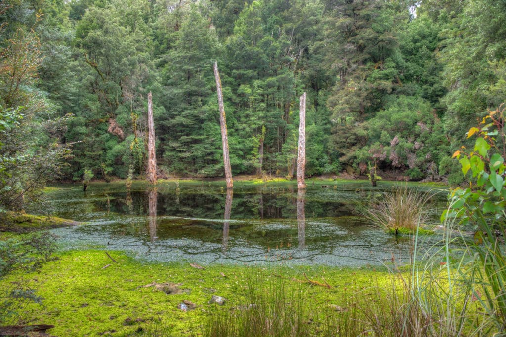
This is another lovely sinkhole located right next to the road. There are a couple of dead tree trunks rising out of the still dark surface of the water which give the spot a somewhat desolate, but appealing character.
It’s not as impressive as the sinkholes at Truwatta Arch or Lake Chisholm, but you can’t have too many sinkholes and it’s the easiest one to see – it’s practically right by the road.
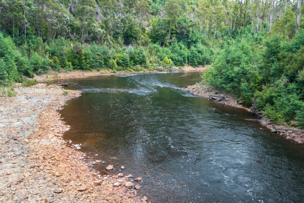
Rapid River
This is another bridge, this time over the Rapid River. You can see the river from the car as you drive across the bridge, or you can park next to the bridge and enjoy a picnic by the river. Like many wild rivers in Tasmania, the Rapid River is tinted dark brown by the tannin that comes from tree roots and leaves.
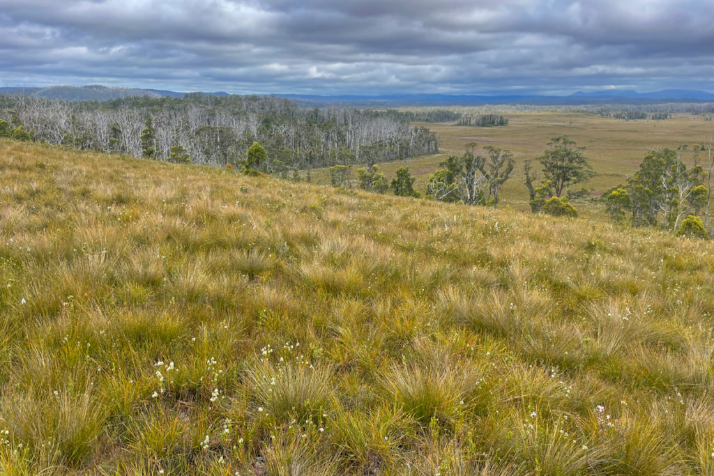
Dempster Plains
Of all the gravel roads we travelled on the Tarkine Drive, the access road for Dempster Plains Lookout (Sumac Rd) is the only road I would say is not suitable for a sedan. This road should really be designated as a 4 WD track.
It’s 3.7 kilometres long and it’s terrible for a small car. It is covered by giant potholes almost as wide as the road and as you drive around them you run the risk of scratching the car on the fallen tree trunks with sharp edges that stick out from the roadside bushes.
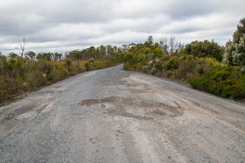
There is no mobile reception in this area so if you get in trouble, you might have to wait the whole day for someone to drive by.
Unfortunately, there is no warning sign at the turn-off, and once you are on this road, there is nowhere to turn around. Anu was driving and the two of us probably lost a year off our lives, stressing about damaging the car or impaling it on one of the pothole edges. We ended up driving at about 10km/hr through the worst patches and it made the drive feel tediously long.
The lookout has a pretty view of an expansive grass plain, but it’s not an absolute must-see. And it’s certainly not worth the nerve-wracking drive to get there.
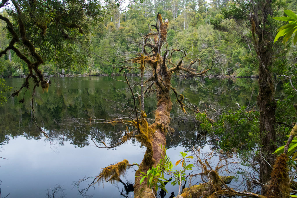
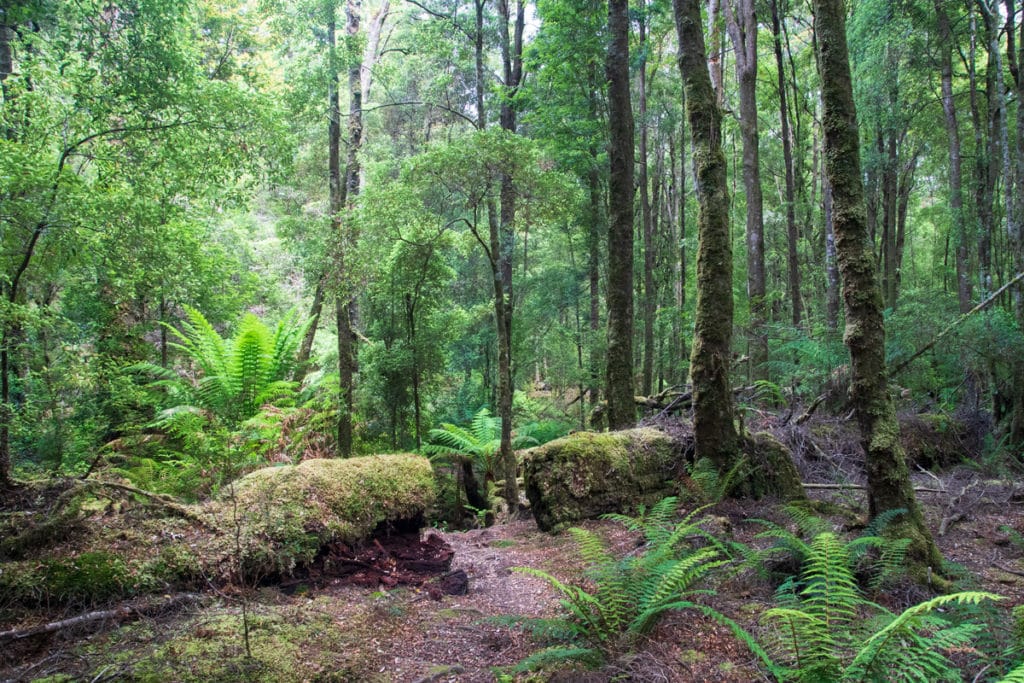
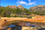
Lake Chisholm
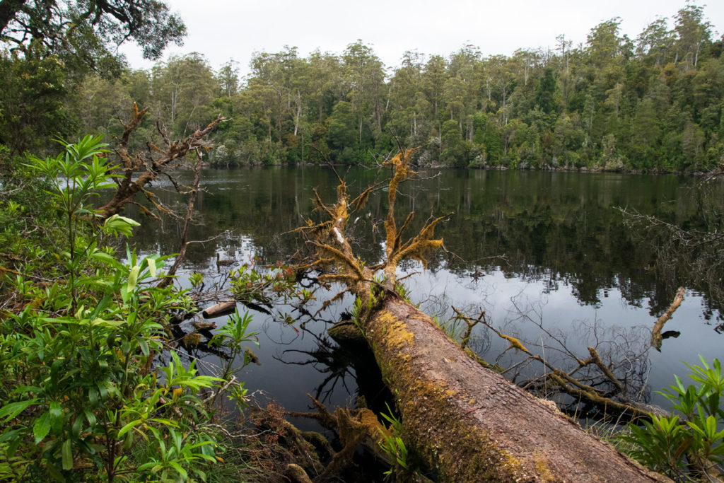
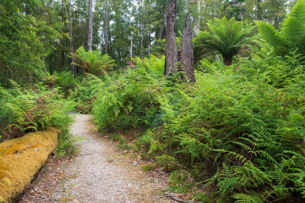
Lake Chisholm is possibly the most stunning part of the Tarkine Drive. This is the Tarkine rainforest at its best. The 4.2-km gravel road to the lake is in great condition which was a huge relief after our Dempster Plains lookout experience.
The 30-min loop walk (1.1 km) from the car park to the lake takes you through some of the lushest temperate rainforests you’ll see in the Tarkine, dominated by the impossibly tall trees covered in moss with their branches draped by the tendrils of lichen.
The lake is a large sinkhole with a mirror-like still dark surface. Or rather it started as a sinkhole but then the drainage ‘hole’ in the sinkhole became blocked by the accumulated organic material from the forest floor. As a consequence, water accumulated in the sinkhole and created this unusual lake.
There are a few tree trunks that protrude from the shore into the lake that you can use as very photogenic vantage points. It’s a fairytale-like scene that you’ll never want to leave.
We didn’t see a platypus in the lake, it was still too early in the day, but we heard a flock of Black cockatoos which are quite common in the Tarkine.
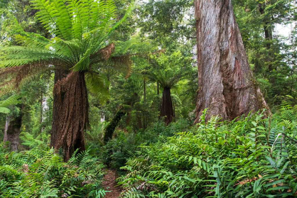
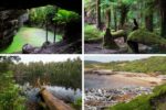
Julius River

Julius River has some of the best amenities on the rainforest section of the drive. There are toilets, picnic tables and BBQ facilities.
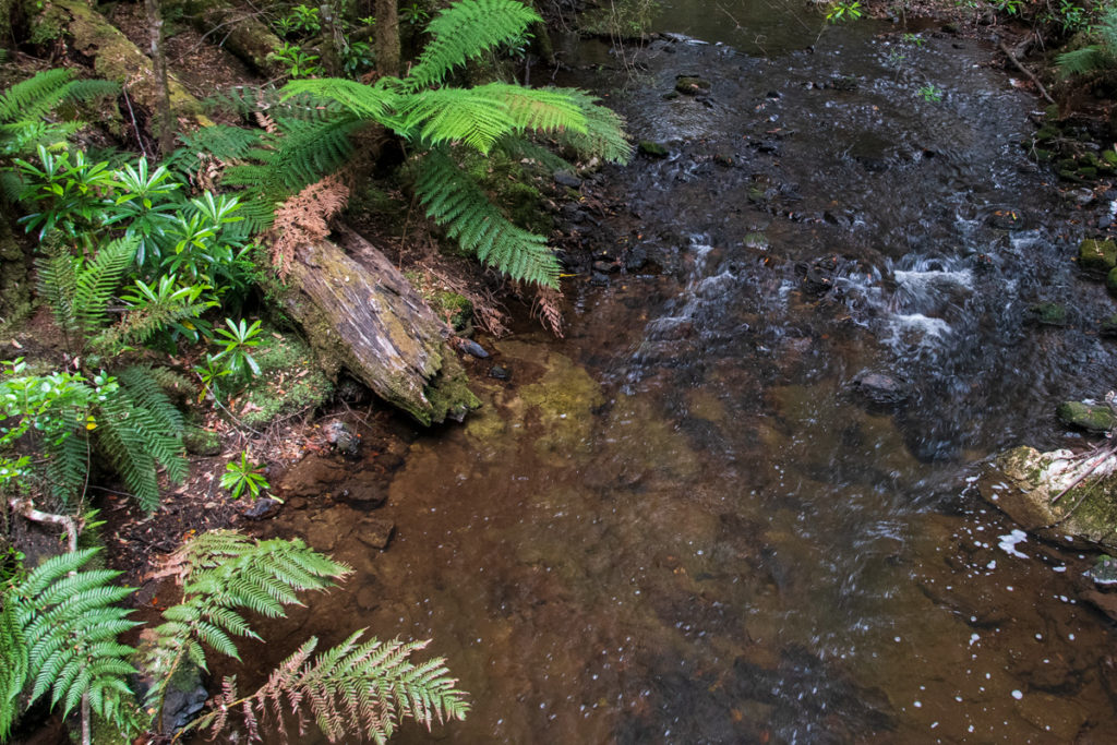
The rainforest at Julius River is almost as gorgeous as at Chisholm Lake. It has that same primeval feeling to it. There are two rainforest walks starting from the picnic area: the prettier 30 min walk along the river and a 40-min walk through the forest.
It was getting late by the time we arrived at Julius River, so we only did the riverside walk. It meanders across a couple of bridges and then follows the river looping back to the car park.
Sumac Lookout
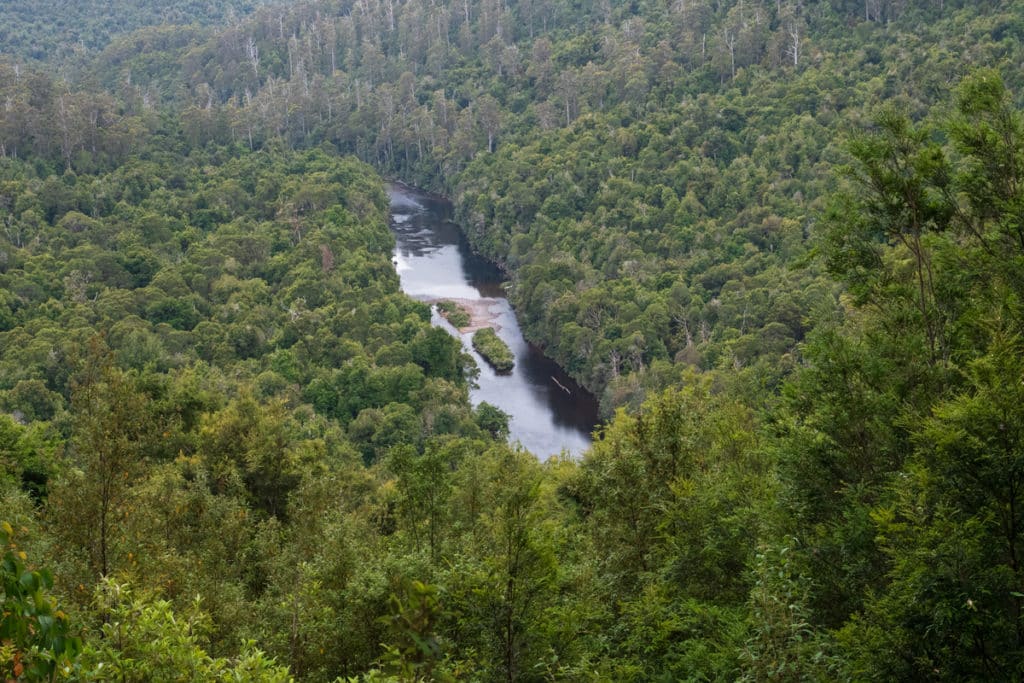
This is a gorgeous lookout that towers over Tarkine wilderness and Arthur River.
As you look over the forest from this birds-eye-view lookout you can see that some trees are much taller than others. These are giant eucalypts and their growth pattern traces the path of an ancient wildfire since eucalypts require fire to reproduce.
The dark green patches of forest along the riverbanks indicate cool temperate rainforest that grows in areas that haven’t been disturbed by fire. Over time the rainforest can permeate and eventually replace the eucalypt forest unless another wildfire halts the process and prepares the way for the eucalypts to dominate again.
The lookout is just a 2-minute stroll from the car park, so it’s a quick but stunning diversion.
Kanunnah Bridge
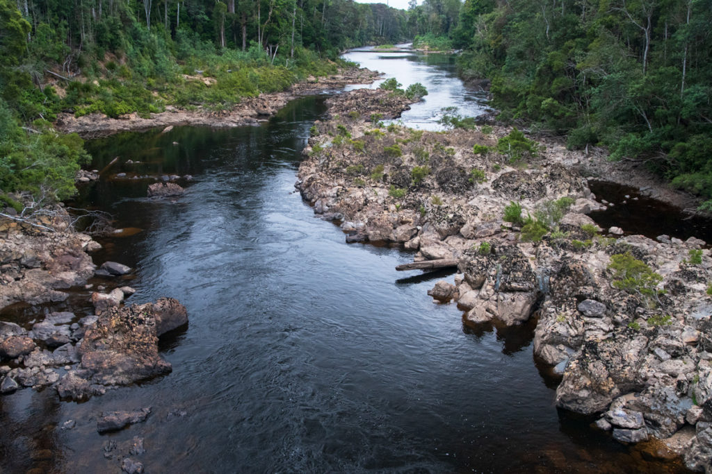
Kanunnah Bridge crosses over the Arthur River and in my opinion, it offers the most photogenic view of the river.
You can see the river from the car, but since it was our last stop of the day, we parked the car at the picnic area on the other side of the bridge and walked onto the bridge to watch the river make its way through the backwood forest.
My favourite bit of trivia is that Kanunnah Bridge takes its name from the Aboriginal word for Tasmanian tiger. Over the years there were a number of unconfirmed reports of Tasmanian tiger sightings in Tasmania. Looking over the Tarkine forest, I think that if there were indeed Tasmanian tigers still roaming the world, this would be the place.
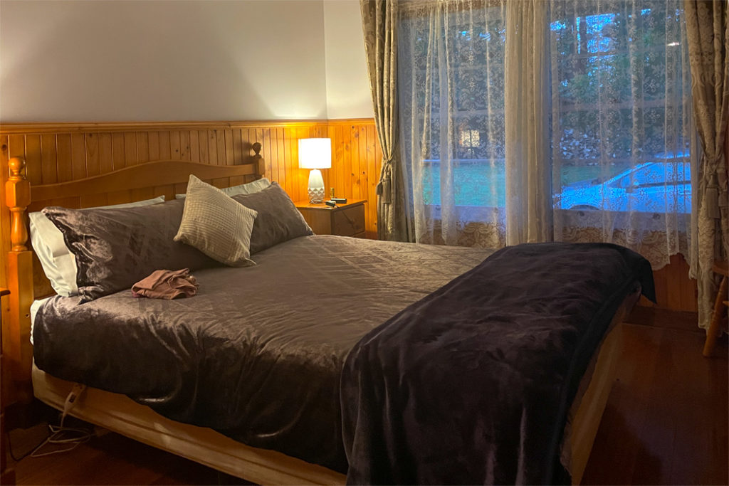
Tarkine Grove Cottage
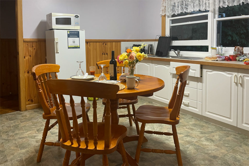
From Kanunnah Bridge we headed to our cozy Tarkin Grove cottage only 13 km away.
The cottage is fully self-contained located within a stone’s throw from the owners’ house, on the same parcel of land.
We cooked a nice spaghetti bolognese and by the time we finished our dinner, it was already dark and there were dozens of Tasmanian pademelons browsing around the house.
Our hosts told us that the property is occasionally visited by Tasmanian devils and Spotted-tailed quolls, and the dam is home to a platypus. We’ve seen Tassie devils and quolls at the Mountain Valley cabins and lots of platypus at the Tasmanian Arboretum just a couple of days earlier. So we didn’t spend too much time sitting in ambush but went on a spotlighting walk instead.
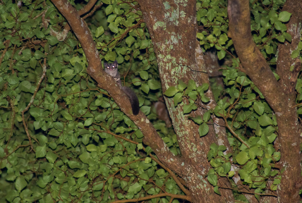
I was hoping to spot a bandicoot, but instead, we found a Sugar glider about 30 meters up a tree, as well as a dark (black and brown) Brushtail possum and a Boobook.
In the morning we went on another exploratory walk around the property to see what birds we could see. There were lots of Fairy-wrens, Fantails, and Tasmanian endemic Yellow wattlebirds.
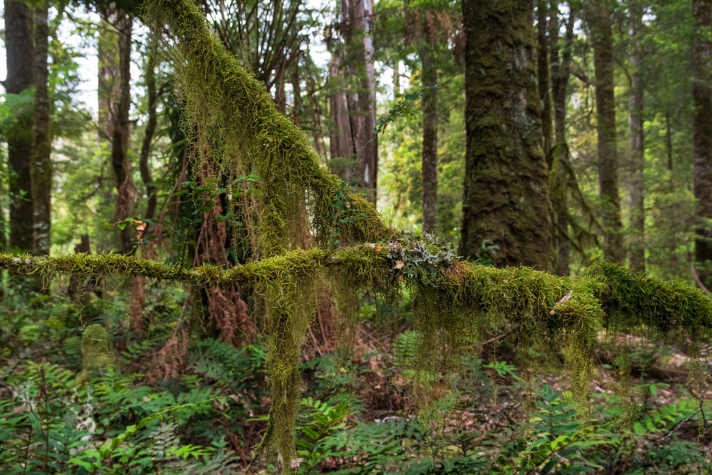
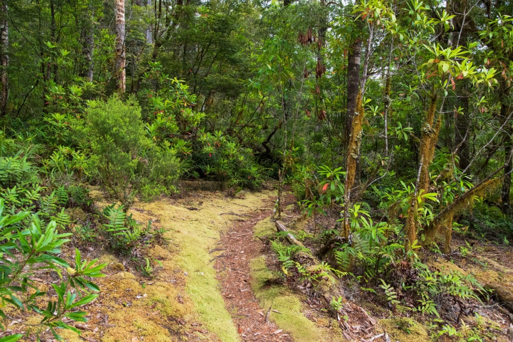
Balfour Packhorse Track
We started our second day on the Tarkine Drive at Balfour Packhorse Track. The track is a section of an old track that originally connected Smithton to Balfour – an old copper mine town that existed between 1902 to 1912. The trail is about 2 hrs return, but we walked only a short section along Stephens Rivulet just to explore this gorgeous rainforest a little.
The trail starts with a short and slippery descent down into the rainforest and then levels out when it reaches the creek and continues over largely flat ground. Just like at Lake Chisholm and Julius River this rainforest is fairytale-like. Moss grows on rocks, tree trunks, and forest floor, tendrils of lichen drape over the branches and colourful fungi grow around tree stumps. This trail is a very atmospheric way to farewell the rainforest before heading towards the coast.
Western Explorer
From Balfour Track the road continues for 33.6 km towards the coast. It’s the longest stretch of road between attractions on the Tarkine Drive but it’s very pretty. About halfway along you pass Western Explorer on your left – a gravel road to Corinna. This is a stunning detour, but to explore Corinna properly, you’ll need to add another day to your Tarkine Drive itinerary.
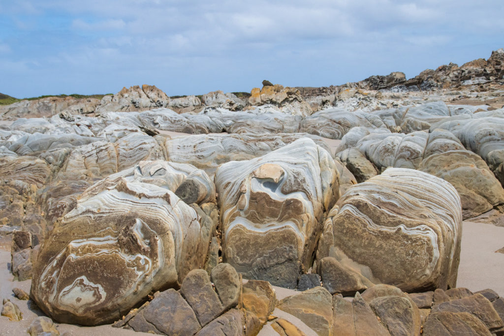
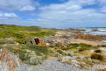
Couta Rocks
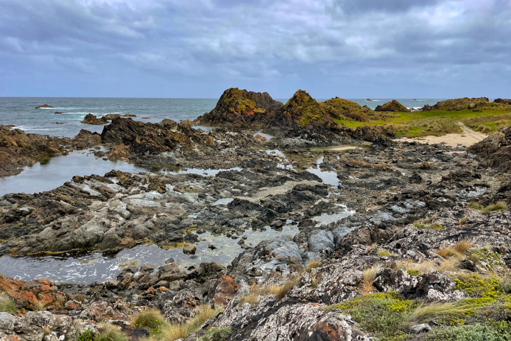
Couta Rocks is a stretch of coastal rocks with a small community of beach shacks, a small rocky bay, and a beach. It is reached by a 1.2 km gravel road that is nice and easy to drive on. When the road reaches the coast, it forks: the right arm goes to the rocky shore and the fishing shacks and the left one to the beach.
You can park at a grassy parking bay and explore the coastal rock formations by following a trail along the coast in either direction.
The beach shacks at Couta rocks are much more substantial than the shacks at Royal National Park in Sydney. They have to be, I guess, to withstand local weather of frosty temperatures in winter and blustery winds at any time of the year.
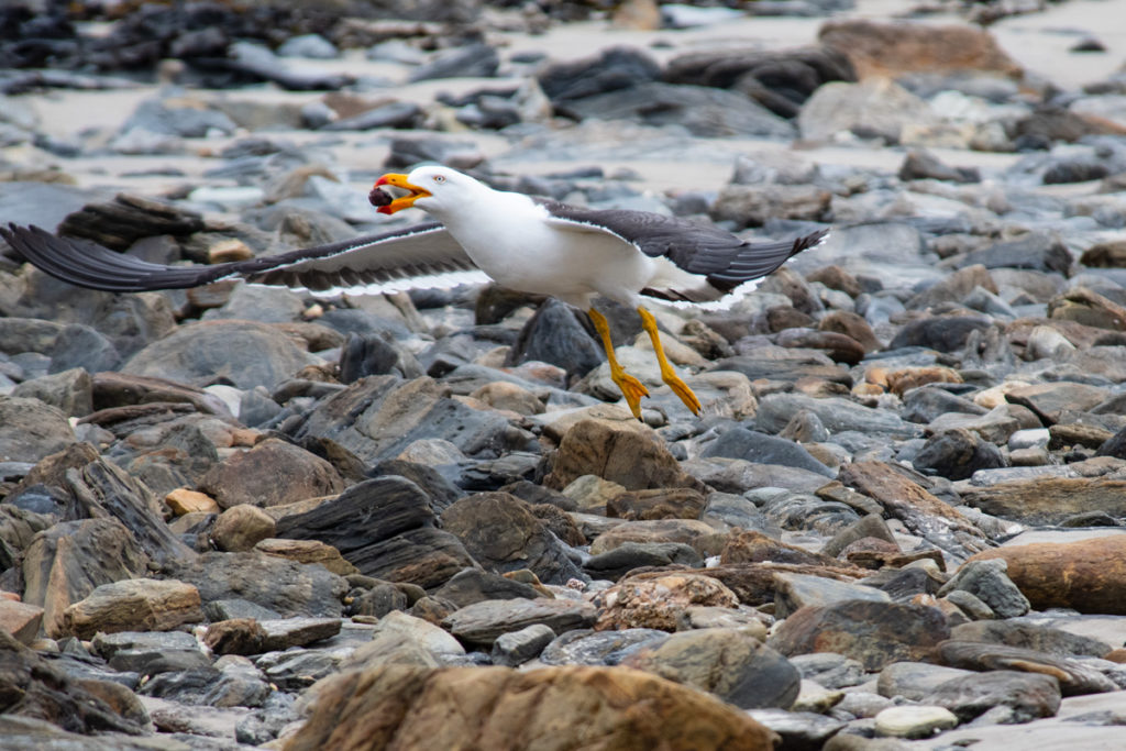
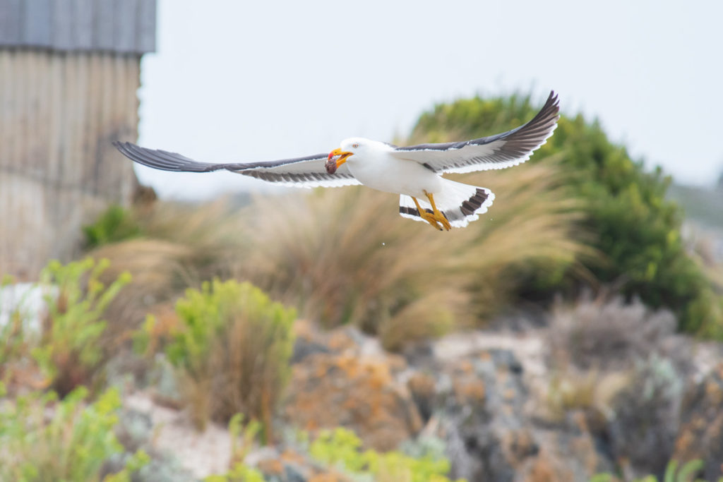
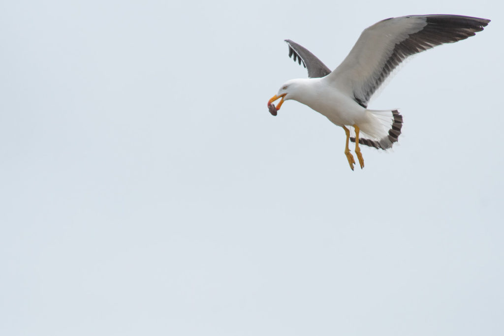
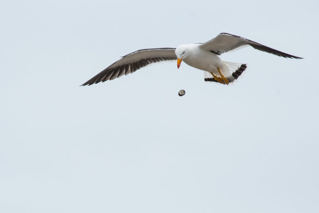
The beach at the other end of the gravel road is an important breeding habitat for various shorebirds. We didn’t spot any waders but did get to watch a Pacific gull using some creative intelligence to get to its lunch.
It would pick up something that looked like a rock oyster or a muscle in its beak, take it to the sky and then drop it onto the rocks repeatedly until it cracked open. Then pick up another one and repeat the process. It seemed to be quite an effective maneuver.
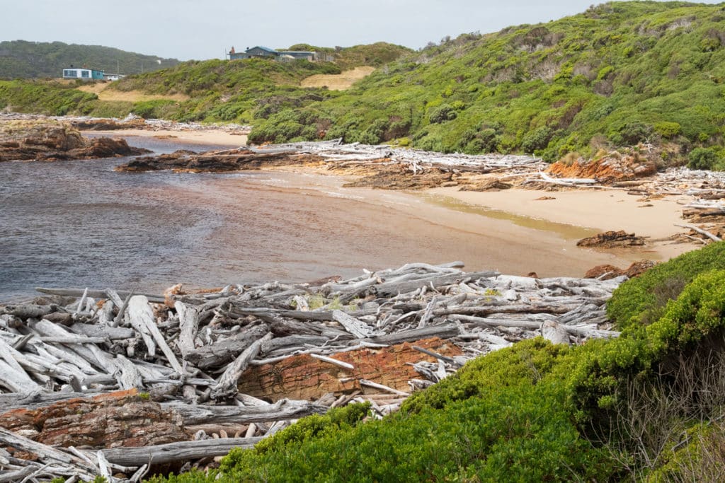
Nelson Bay
Tasmania’s Nelson Bay is quite different to the popular Nelson Bay in Port Stephens, NSW. Undeveloped and wild, Tassie’s Nelson Bay is a section of rocky coastline and wild sandy beaches. It is reached by a 2.3 km gravel road, and like Couta Rocks, it can be explored by walking along a coastal trail.
The beaches of Nelson Bay are also designated as Sensitive Bird Breeding Area and we did spot a few adorable Pied oystercatchers on the beach.
Sundown Point State Reserve
From Nelson Bay road you can continue to Sundown Point State Reserve. The most fascinating thing here are the ancient Aboriginal rock carvings along Sundown Creek. It’s a 1.5 hr walk across the beach to the mouth of the creek where the carvings are, and unfortunately, we didn’t have enough time to do this walk.
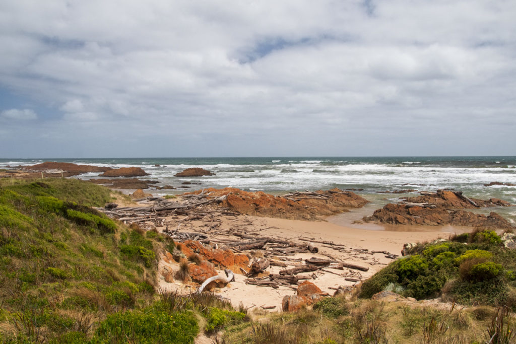
Edge of the World
The Edge of the World was our absolute favourite stop on the Tarkine coast, even though it is, in relative terms, the most developed section of the drive since it sits right next to the township of Arthur River. The views of the rugged coastline here are spectacular and extend for 180 degrees.
There is a sheltered lookout right next to the car park, but you should brave the roaring winds and walk out to the point where a plaque marks the designated Edge of the World.
Technically, this is not the western-most point of Tasmania, but as you gaze across the turbulent ocean, keep in mind that the nearest land from here is the coast of Argentina some 20,000 km away. So while this may not be literally the edge of the world, it certainly feels like it.
“I cast my pebble onto the shore of Eternity.
To be washed by the Ocean of time. It has shape, form, and substance. It is me.
One day I will be no more. But my pebble will remain here.
On the shore of eternity.
Mute witness from the aeons.
That today I came and stood At the edge of the world.”
Poem by Brian Inder printed on the plaque
In terms of practical details, the road is sealed almost all the way to the car park and there are decent toilets nearby – the only ones on the coastal section of the drive.
Arthur River
Arthur River is a sleepy little village that could be a great base for exploring the Tarkine Drive. There is a general store and a takeaway here, and some lovely accommodation options, though they book out quickly, so book early.
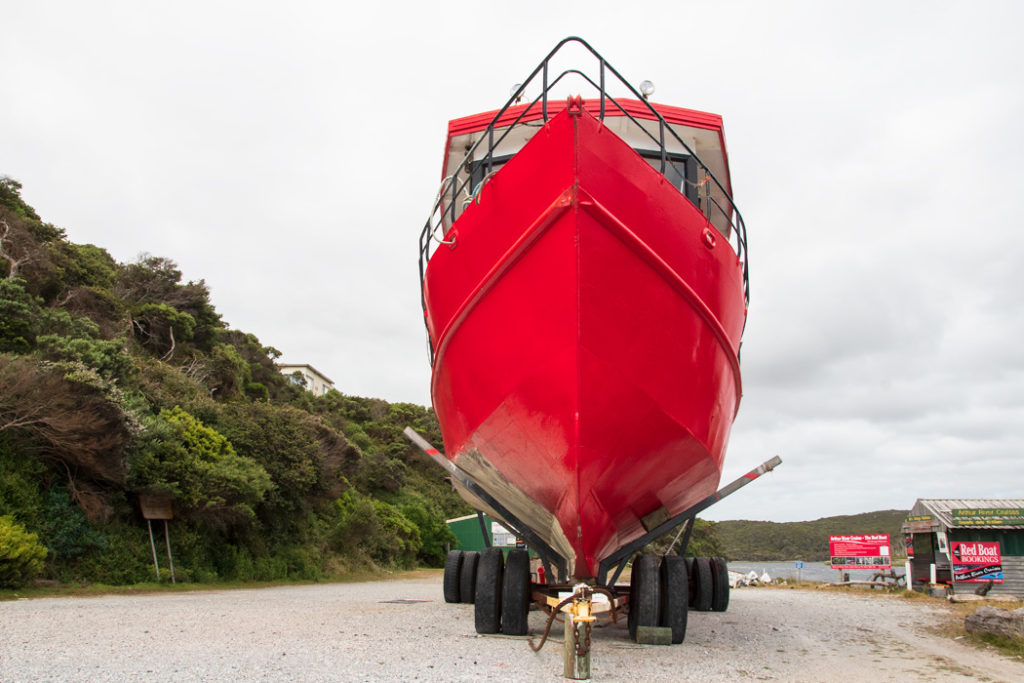
If you stay at Arthur River, you can take the famous Arthur River cruise. The cruises leave at 9:50 am and return by 3:15pm. The iconic red boat is currently out of the water, so the cruises are currently offered on the deluxe cruise boat.
There is also an 8.4-kilometre Coastal Walk that starts in town and travels north along the rugged coastline. You obviously don’t have to complete the entire track, just walk for as long as you like and turn around when ready.
Another perk to staying at Arthur River is that you can visit the Edge of the World lookout at sunset, or sunrise if you are a morning person.
Bluff Hill Lighthouse
We missed the Bluff Hill lighthouse turn-off and had to go back and look closer at the road signs. The sign is quite indistinct located practically in the roadside bushes, so it’s easy to miss.
The gravel road to the lighthouse is about 3.2km. The lighthouse is not very large or particularly pretty, but people tend to like lighthouses. The view from Bluff Hill would’ve been quite stunning if the hill was a little higher. You can still see a good stretch of the Tarkine coastline from here, but it is distant and a little flat without the elevated perspective.
West Point State Reserve
Known for its massive surf, West Point is a rugged, wild, and turbulent spot. It has the longest access road (5.5 km) of all the gravel roads on the Tarkine Drive. It is a good road though and easy to drive on.
When you get to the coast you may just be the only person there. We surely were. But then again, we were practically the only car on the entire rainforest section of the drive.
In any case, West Point feels remote and wild. There are some gorgeous red lichen-covered rock formations to explore and of course, the thundering sound of the surf to enjoy.
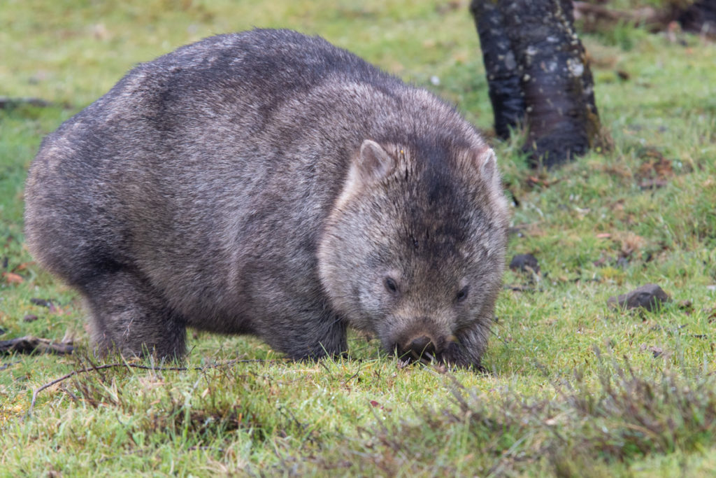
As if to highlight the wild atmosphere of the area, a wombat ambled on the side of the gravel road when we were driving back. So we got to finish our Tarkine Drive adventure on a high note.
Final Thoughts on the Tarkine Drive
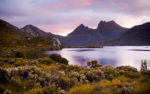
From the Cradle Mountain to the Tasman Peninsula, there are many well-known stunning nature destinations in Tasmania, while the Tarkine Wilderness remains mostly off the tourist radar. It is the perfect opportunity to get off the beaten path and immerse yourself into the world of ancient rainforests with murky sinkholes and wild rivers, and a dramatic coastline battered by the roaring winds. Tarkine feels a world away from everything else, where, as Anu puts it, you can lose and find yourself at the same time.
More Nature Destinations in Tasmania
- Things to do in Cradle Mountain: Walks, Wildlife & Adventure

- 10 Best Day Trips from Hobart, Tasmania

- Tarkine Drive: 2-Day Itinerary, Attractions & Accommodation
- Things to Do on Bruny Island: Guide to Itinerary Planning
- 15 Best Things to Do in Launceston: Where to Play, Eat, and Stay
- North West Tasmania Travel Guide: Iconic Highlights & Local Secrets
- Mountain Valley Wilderness Holidays Review
- Travel Guide to Edge of the World, Tasmania
- Visiting Gunns Plains Caves in North West Tasmania

- Gorgeous Beaches in Tasmania: North-West Coast


This is a magnificently detailed article on the Tarkine where we’re heading in January, we appreciate you sharing the details to help other travellers, great work, and thank you
Thank you Frank! I am glad the details are helpfull. Enjoy the spectacular drive!
What a great post! I got engaged in Tassie in August (woohoo) but we only stopped at a fraction of these spots – all the more reason to go back soon!
Awww, that’s beautiful! Congratulations, Ellen :)
Squeeee Margarita this all looks incredible! I love wild areas like there where there is just sooo much to see within just a few hours drive. It’s pretty amazing how diverse the scenery, trees and rock formations are, but the thing that reeeeally makes me want to visit Tasmania is all that wildlife. What a fabulous area.
Thanks Josy. Wildlife watching in Tassie is superb! I knew it would be, but I was still blown away.
Absolutely gorgeous photos. I can imagine how breathtaking this place is in person. A great detailed post for anyone looking for a really off the beaten path experiences.
Thank you, Ava, it really is stunning beyond anything photos can capture.