This trail is currently closed due to flood damage. Check the National Parks website for updates.
My Walls Cave adventure did not go to plan. It was a last-minute decision after our camping plans for the weekend went pear-shaped. I wanted to do the Walls Cave walk for quite some time, and since it recently re-opened after the 2019 fires, I decided to spend my Saturday exploring it.
The weather was perfect – overcast sky produced soft even light – perfect for photographing creeks and canyons. And while the Walls Cave walk is named after the impressive Walls Cave at the end of the trail, what I wanted to explore was the small canyon that you walk through to get to the cave.
Of course, as often is the case, by the time I got to the Blue Mountains, the sky cleared up and the sun was shining brightly casting harsh light and deep shadows on the landscape.
But while my photographic adventure was compromised, the bushwalking adventure worked out just fine. The Walls Cave canyon and the cave itself are very interesting spots to explore. And here is everything you need to know about Walls Cave walk in Blackheath to plan your own adventure.
Track at a glance
- Distance: 2 km return
- Time: 1 hr
- Grade: Moderate
Walls Cave Walk
The walk starts at the car park on Walls Cave Road, which is just off Evans Lookout Road in Blackheath. From the car park you see a gate with a small turning gate on the side. Only walkers are allowed past this point.
Once you walk through the gate, you’ll see an information board that explains a few things. First of all, Walls Cave trail is adjacent to a restricted area managed by Sydney Water. So it’s a good idea to stick to the trail unless you are keen to risk an $11,000 fine. In any case, the Walls Cave trail is by far the most interesting feature in the area.
Another sign explains that the walking trail passes through Darug Aboriginal Country and Walls Cave itself is of special significance to Darug people so please treat the walk with respect and stay within the fenced area at the cave.
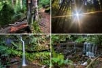
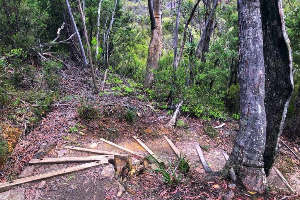
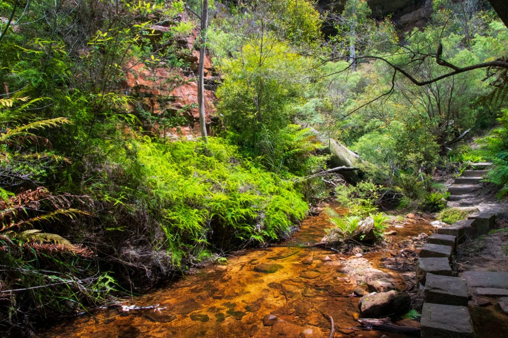
From the information board, Walls Cave walk is well signposted. The trail winds down along a series of steps all the way down to Greaves Creek – the same creek that flows through the Grand Canyon further up Evans Lookout Road. The descent is quite gentle, but it will be harder on the way up.
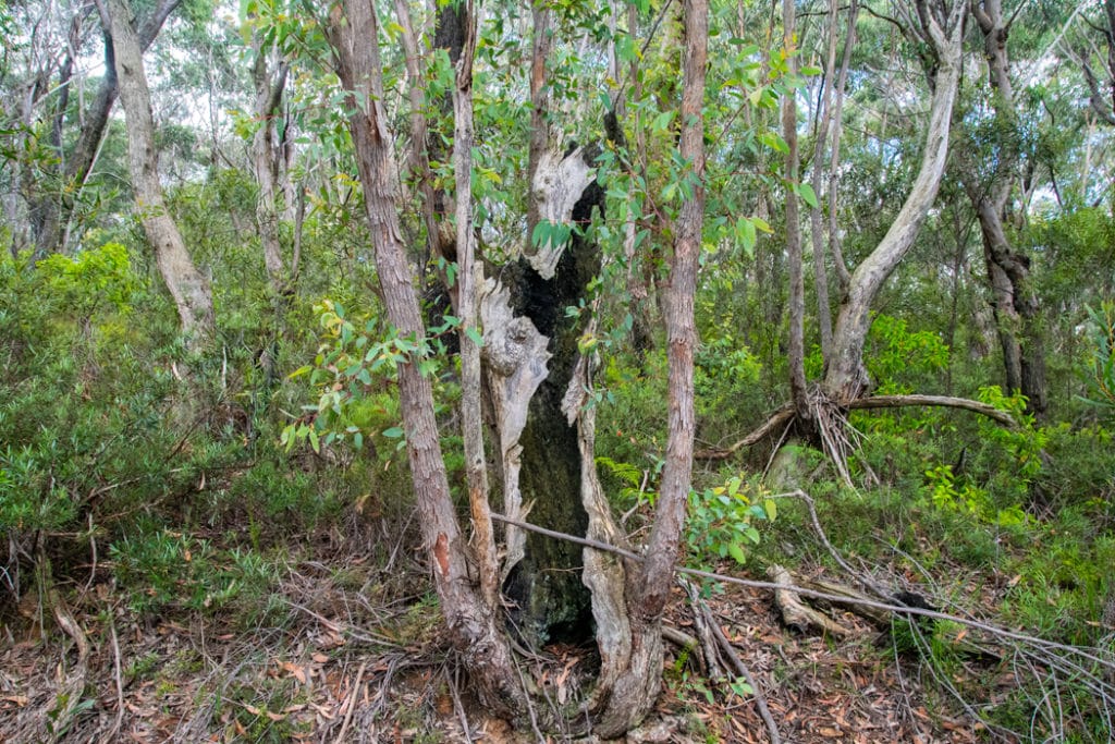
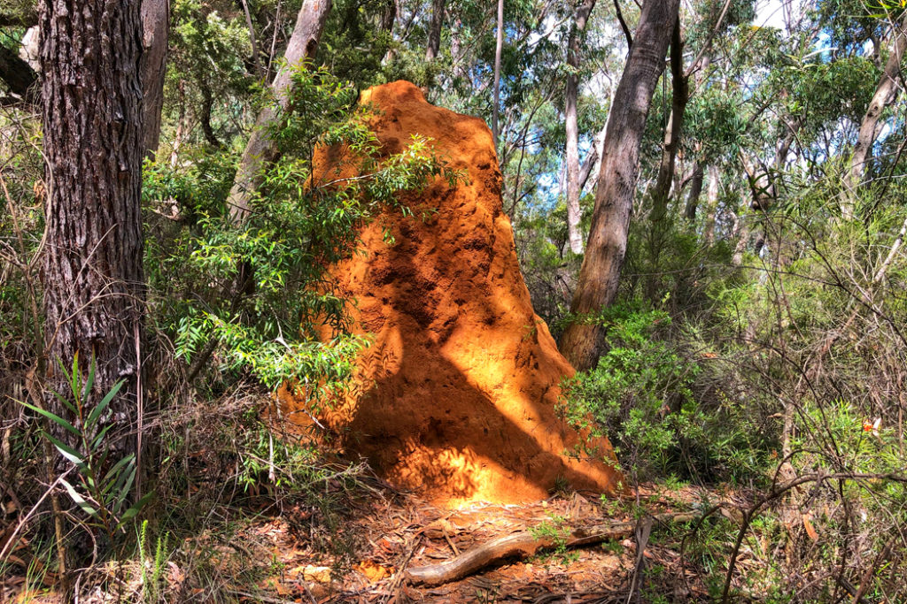
For the first couple hundred meters, the walk goes through eucalypt woodland. There is an impressive termite mound on the left side of the trail and a few burned out eucalypt trunks. It never ceases to amaze me how during a bushfire, eucalypts can literally explode from the inside yet remain living if the conditions after the fire are good enough.
READ MORE: Things to do in the Blue Mountains by train
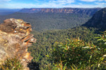
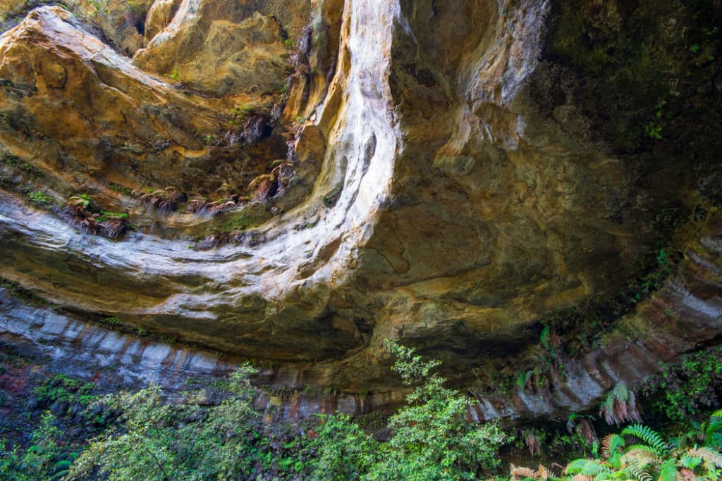
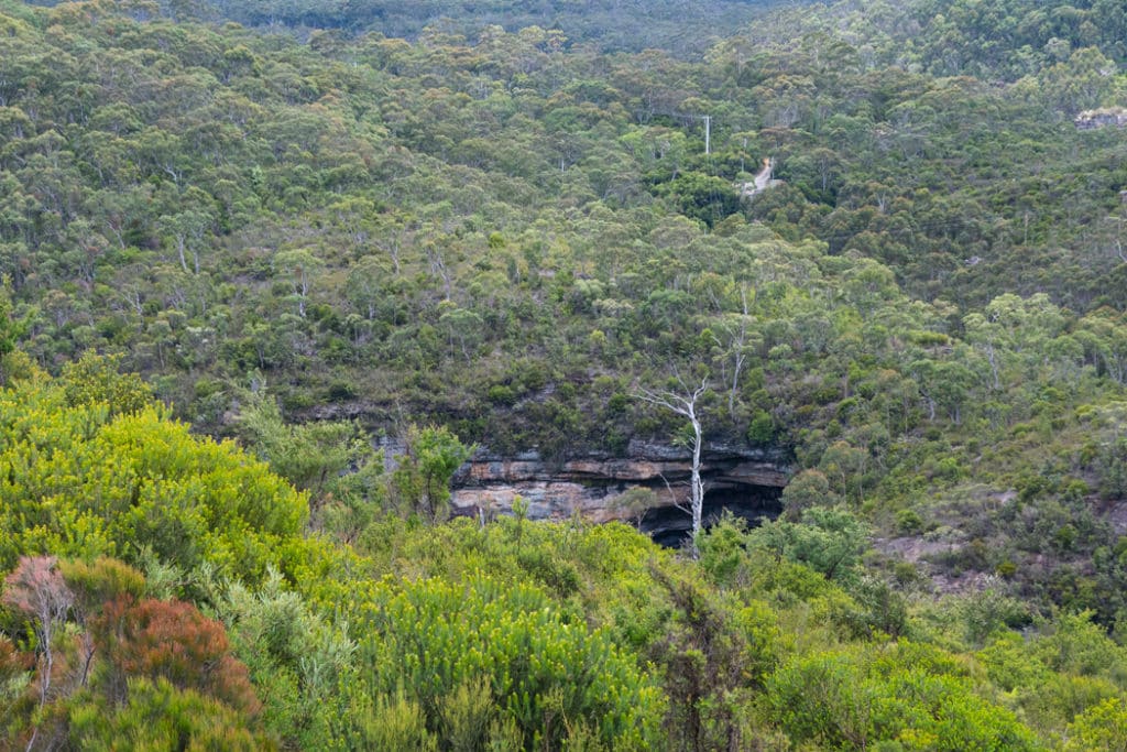
Soon, the trail opens up, vegetation changes to heath, and you get your first view of Walls Cave, gaping like an open mouth on the side of a forested mountain.
As you keep walking towards the cave, you soon come to a fork in the trail, at around the 500-meter mark. Take the trail going to the right, towards to cave that you can see from the trail. Here the trail becomes narrower and the descent – steeper, with a few switchback sections.
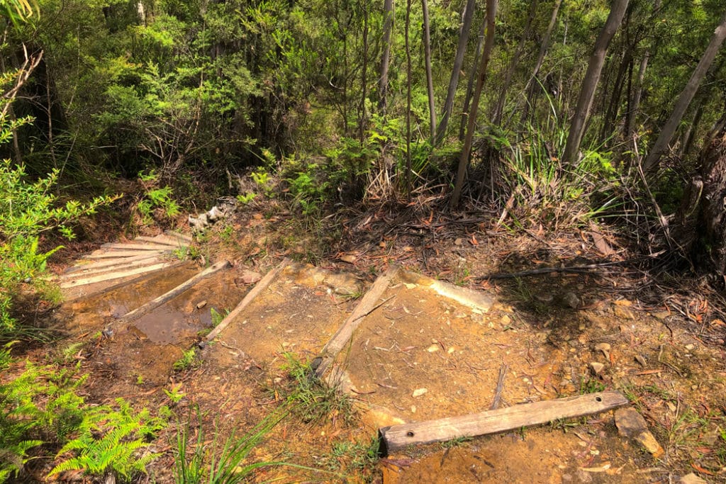
After the rain, some of the steps fill with water and these puddles are deeper than they look. So if you are not wearing waterproof hiking shoes, you’ll want to watch where you place your feet.
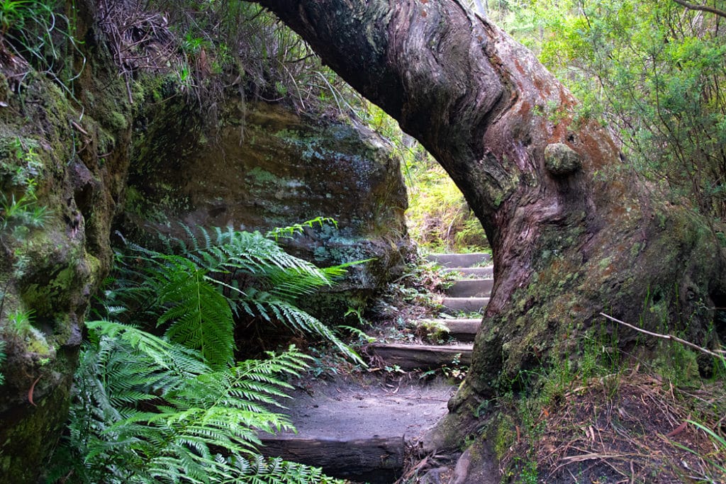
At about the 900-meter mark, just before you reach the bottom of the canyon, there is another fork in the trail. This time, follow the more defined trail that goes straight, the one with the steps. I explored the other trail on the way back and will describe this little gem below.
The Canoyon
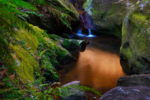
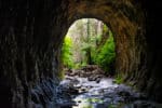
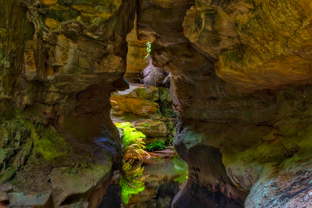
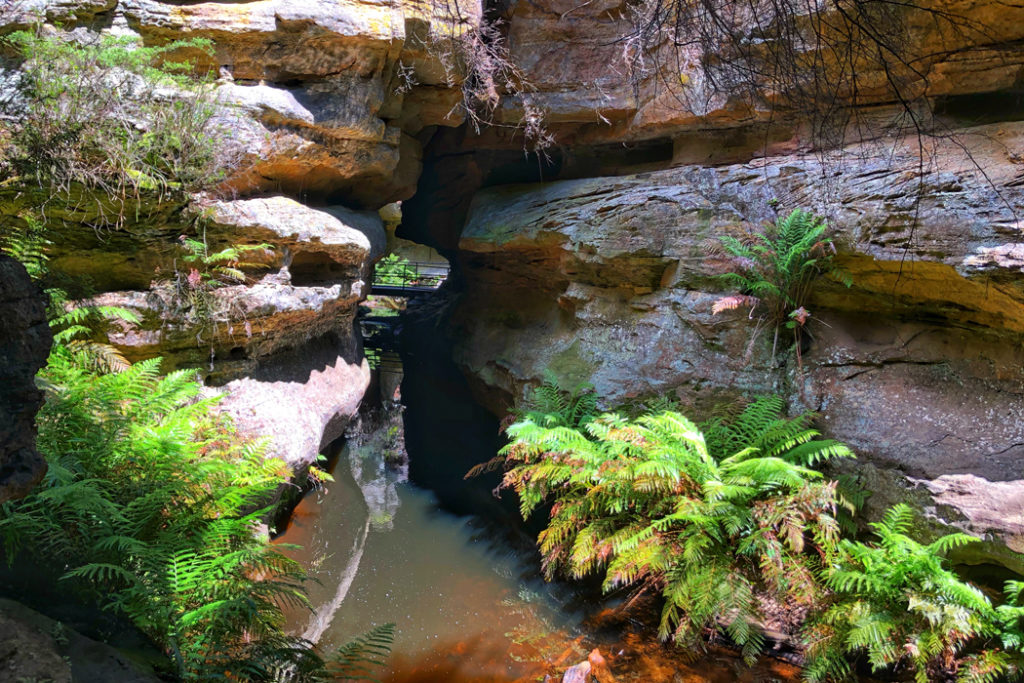
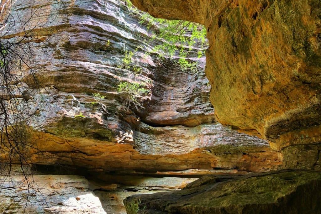
You enter the canyon via a small bridge and the view from this bridge is the most interesting sight on the walk, in my opinion. On your right, you are looking into a slot canyon through a tunnel formed by the canyon walls. The walls and the ferns growing inside the slot canyon are reflected in the creek creating a very photogenic scene.
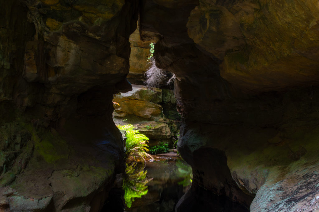
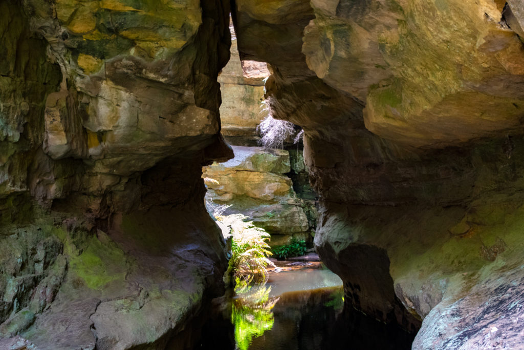
It’s a tricky scene to photograph because of the high dynamic range created by the sun, but your eyes do a much better job than the camera. To the naked eye, the canyon looks superb.
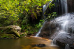
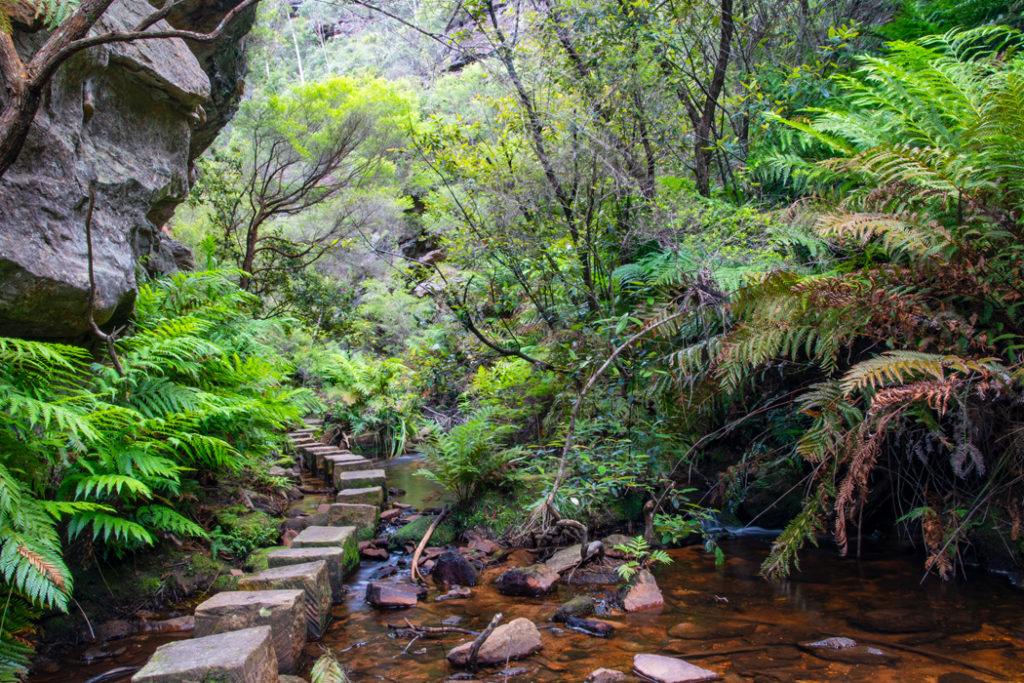
The rest of the walk along Grieves Creek is very picturesque. There are a couple of areas where you walk over the creek on stepping stones before rejoining the path for a short walk to Walls Cave.
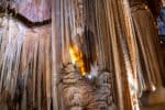
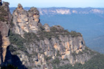
Walls Cave
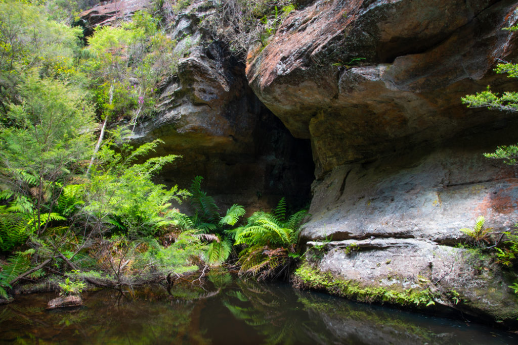
The cave is very impressive, similar to the Blackfellows Hand cave near Wolgan Valley, but not as large. The trail ends at a fenced-off viewing area in the middle of the cave. Washed out by Greaves Creek over the eons, the cave is more of a massive rock overhang than a cave, like most Aboriginal caves in the Blue Mountains.
As the sign at the start of the walk explian, Walls Cave was occupied by the Aboriginal people. It is easy to see the appeal of this site – easy access to drinking water and shelter provided by the rock overhang.
The first Europen to see the cave was Mr Walls who owned the land on which the cave is located in 1890s.
Slot Canyon Side Trail
As I mentioned before, on my way back, I followed the trail that forked off the main trail just above the canyon. It wasn’t much of a trail, more of a rock scramble but it took me inside a section of the slot canyon that I was looking into from the bridge. There is a short ledge here that you can walk on and from that ledge, you are looking into the same tunnel with a bridge visible through the gap. It’s quite an interesting little spot surrounded by the canyon walls on all sides.
It’s wasn’t great for photography under the blazing early afternoon sun, but it was a nice discovery. Here are some rather average images of the canyon. Have a look at this stunning image by Gary Hayes to see what the canyon looks like on a better day for photography.
The walk back follows the same trail and walking up the steps is slower going than walking down. Allow yourself plenty of time for the return walk and use the opportunities to have another look at the cave from the trail to catch your breath.
How to get to Walls Cave trail
Driving: From Blackheath, follow Evans Lookout road for about 2 km and turn right on Walls Cave road. Parking is available at the end of this short road and the start of the walk is well signposted.
Train: The easiest way to get to Walls Cave trail by public transport is to catch a train to Katoomba and then take the 698 bus (check the schedule here). Get off the bus either at St Andrew’s Ave or at the next stop on Evans Lookout Rd. From here it’s only a 10 min walk (800 meters) to the start of the trail.
More Things to do in the Blue Mountains
- The Lost World of the Grand Canyon Track in the Blue Mountains

- Blue Mountains by Train: Walks, Views and Waterfalls
- Blue Mountains Jenolan Caves – how to explore the world’s oldest crystal caves
- The Giant Stairway and the Dardenelles Pass – An Epic Walk in the Blue Mountains
- Prince Henry Cliff Walk in the Blue Mountains – Epic Views and Waterfalls
- Echo Point to Scenic World walk in the Blue Mountains
- Best way to visit Wolgan Valley & Lithgow Glow Worm Tunnel
- South Lawson Waterfall Circuit Walk – One Walk, Five Waterfalls
- Finding Fireflies and Glow Worms in the Blue Mountains

- Glow worms and Waterfalls of Horseshoe Falls Walking Track in Hazelbrook