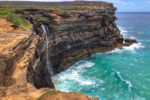

One of Sydney’s most popular coastal walks, Wattamolla to Curracurrong Falls in Royal National Park, is a spectacular trail. It travellers along the clifftops towards Sydney’s only waterfall that flows directly into the sea and hides one of Sydney’s most atmospheric swimming holes – Curracurrang Falls. That’s right, two waterfalls within a few hundred meters of one another, and one is called Curracurrong (the big one) and the other Curracurrang (the tranquil one).
There are three different trails in Royal National Park that lead to Curracurrong Falls: Wattamolla to Curracurrong Falls, Garie Beach to Curracurrong Falls and Curra Moors trail. This guide is for the walk starting at Wattamolla.
Track at a glance
- Distance: 7.2 km return
- Grade: 3 – Moderate track
- Walking time: 3 – 4 hrs
- Amenities: Bathrooms at Wattamolla car park
Wattamolla
Before you start your Wattamolla to Curracurrong Falls walk, spend a few minutes exploring Wattamolla. There is quite a bit to see here.
Wattamolla is one of the most popular picnic spots in Royal National Park, so it gets quite busy on the weekends and public holidays, even in winter. But on the trails, the crowds thin out. In terms of facilities, Wattamolla is geared towards picnickers. There are wooden tables and benches, BBQ facilities, a good and clean toilet block and two car parks.
If you are planning a picnic, you will need to bring all your food and water. There is a kiosk here, but it opens only on weekends. Water is available at Wattamolla, but it needs to be filtered prior to drinking. There is also no mobile reception here, so prepare for a digital detox for a day.
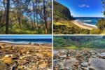
There is a big map installed in the lower car park, which is very handy for orienting yourself in the area. It shows where you are along the coastline, where you can hike and the local scenic spots. Before you start the track to Currawong falls, check out a few scenic spots at Wattamolla. There are Wattamolla falls, Wattamolla Lagoon and Wattamolla beach.
Wattamolla Falls
Wattamolla falls are nothing to write home about, but since you are here, you may as well have a look. They start with some lovely cascades that can be reached by a 5-minute walk from the lower carpark at the start of Wattamolla to the Little Marley beach track. The main waterfall is a single drop fall that empties into Wattamolla lagoon. You can see and photograph it by following the signs to the lagoon from the lower car park.
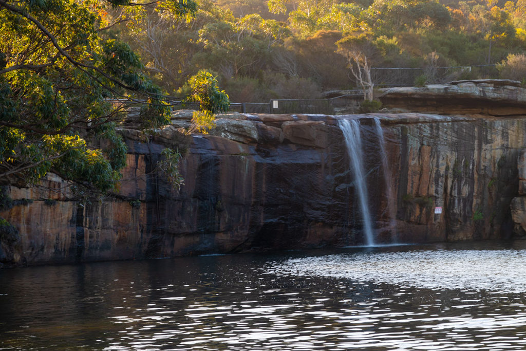
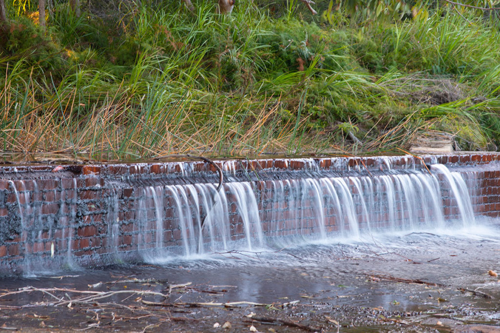
Although if you are really interested in photographing Wattamolla falls, it’s best to visit the lagoon in the afternoon when the sun has moved lower in the sky, and the falls are uniformly shaded. In the middle of the day, the sun falls across the falls creating too much contrast.
Wattamolla Lagoon
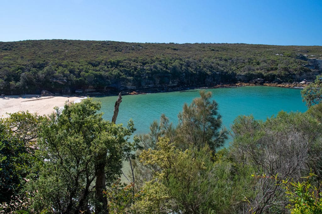
Tucked away from the powerful surf, Wattamolla lagoon is a popular swimming destination in Sydney. It is quite large and sheltered, with a white sandy beach on one side and a forest on the other. You can reach the forested side of the lagoon via a short walk from the lower carpark. It is also a good spot to see the waterfall. However, to reach the beach side of the lagoon, you will need to walk across the Wattamolla beach.
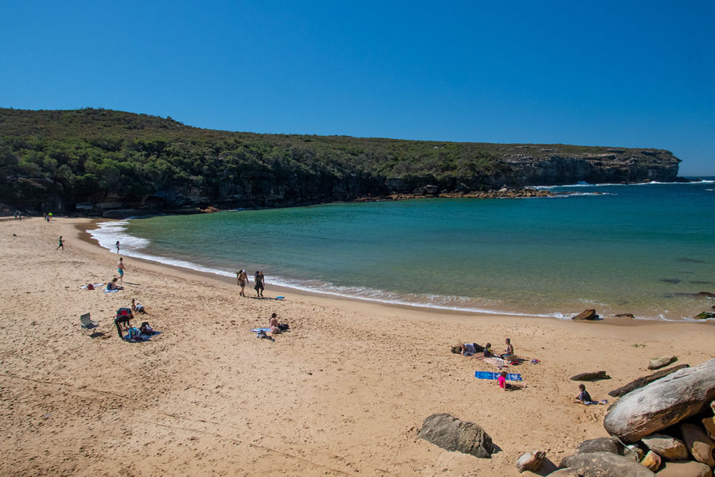
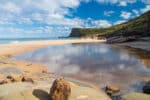
Wattamolla Beach
Wattamolla lagoon flows into the ocean across Wattamolla beach. The beach at Wattamolla is not great for swimming unless you are a very confident swimmer. There is a sharp drop of about 5 meters from the shore. Which is another reason why the lagoon is so popular.
To reach the beach, follow the signs past the toilet block and the upper car park and across the grassy clearing. The trail to the beach leads you along a set of stone steps, and the views from the trail are quite inspiring.
At low tide, you can explore the rock formations alongside the cliff that frames the beach. But be careful walking on the slippery rocks.
Wattamolla Beach to Providential Point Lookout
From the beach, turn left and walk across the grass clearing for a few meters until you reach the signposted walk to Providential Point Lookout. The trail starts on a metal boardwalk and immediately ducks into the forest. After the initial flat walk, it starts to climb towards the cliff top and about halfway up the cliff you reach the lookout.
It’s actually a double lookout, both with panoramic views of the Pacific Ocean and the coastline of Royal National Park. Providential Point is the southern headland framing the bay, Wattamolla Beach and Lagoon.
Providential Point Lookout to Curracurrang
From the lookout, keep following the trail up and once you reach the top of the cliff, you are on Coast Track. From here, the track follows the coast along a metal boardwalk all the way to Curracurrong Falls. If you are visiting in late winter, like I did, the headland will be dotted with wildflowers in various shades of yellow, purple and red.
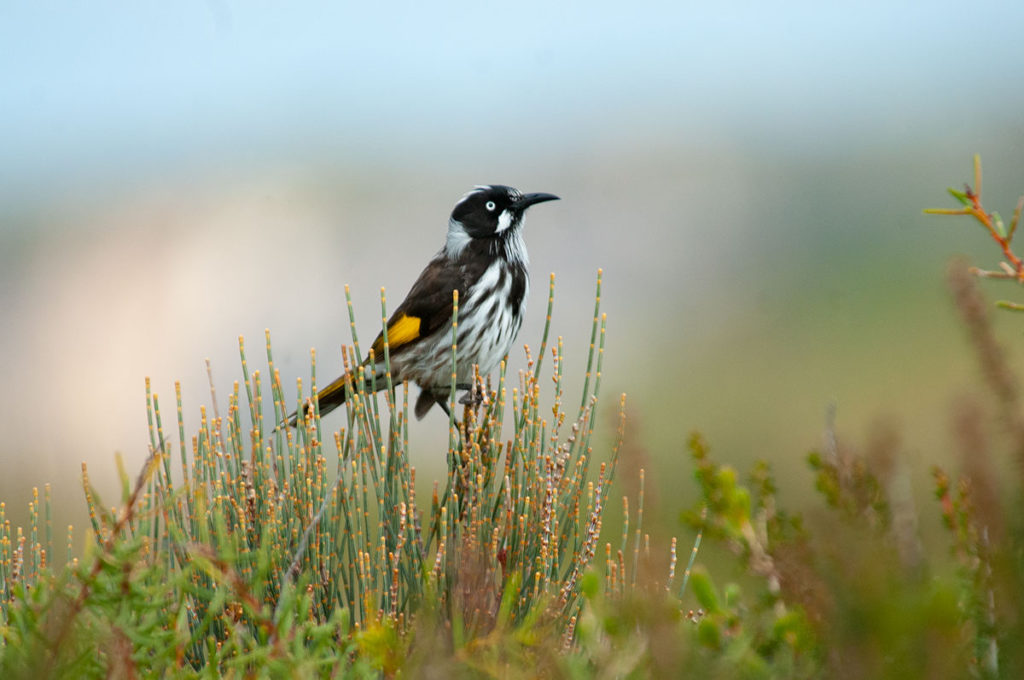
Among the bushes, New Holland honeyeaters and Little wattlebirds chase their lunch and each other while Welcome swallows chirp while flying at a break-neck speed above your head. Occasionally a White-bellied sea Eagle would soar overhead. As you walk along the clifftop, lookout for a small brown bird – it’s a Rock warbler that occurs only in NSW. And if you are lucky, you can spot Humpback whales as they cruise past the park’s coastline on their epic migration between Antarctica and the Great Barrier Reef.
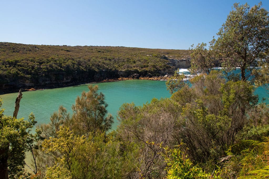
As you walk along the cliff top, you come across two picturesque coves where the water is shallower and appears deep blue-green from your high vantage point. There are plenty of rocky perches to sit on with your feet dangling 80 meters above the ocean and enjoy the view.
Once you reach Curracurrang cove and a little creek crossing you are halfway to Curracurrong Falls and Eagle Rock. This cove is a lovely spot to have a break and have your lunch or a snack.
Aboriginal heritage of Curracurrang
Strangely, this cove and the creek that runs along the gully here are called Curracurrang while the falls 1.8 km away and the creek that feeds them are called Curracurrong. Both names, no doubt, originate from the language of the Dharawal people who lived in the area and Curracurrang and Curracurrang are probably related words. Maybe they are feminine and masculine versions of the same word (like an animal’s name)?
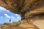
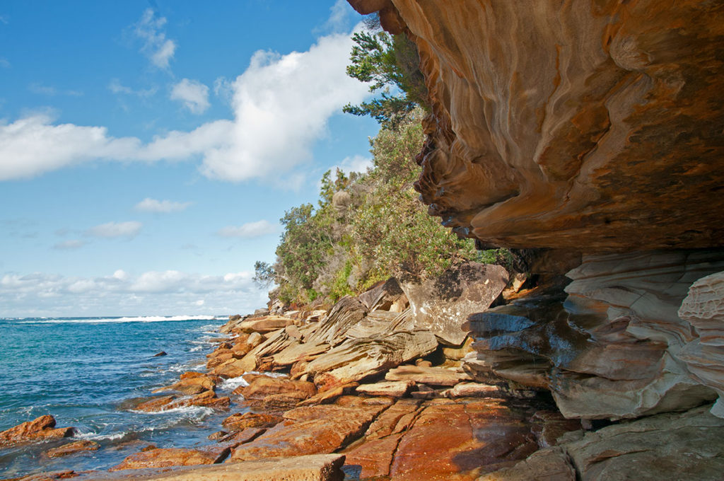
Royal National Park has a rich Aboriginal history. There are at least 8 rock shelters in the Curracurrang area. Some of them show evidence of Aboriginal occupation up to 7,500 years ago.
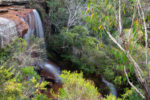
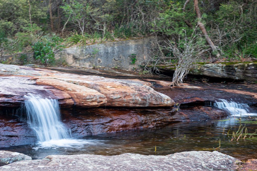
Detour to Curracurrang Falls
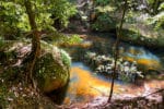
The Curracurrang creek area hides a gorgeous secret – just a few hundred meters away from the main trail and the coast there is a tranquil swimming hole fed by Curracurrang Falls.
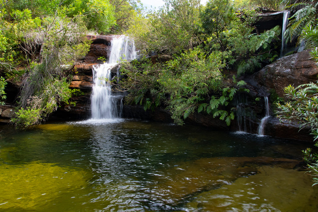
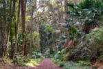
To find Curracurrang Falls, follow the faint trail that leads into the bush alongside Curracurrang Creek. The trail may appear disused and overgrown, but that’s part of its charm.
The walk along the creek takes you through a beautiful patch of palm-dominated littoral rainforest, under a huge rock overhang with signs of human habitation (probably around the 1930s) and finally brings you to a swimming hole with crystal clear water and a waterfall cascading down a sandstone outcrop.
The swimming hole is incredibly inviting. It’s easy to get into via natural rocky steps and it is deep enough for a proper swim. Best of all, you can swim underneath the waterfall surrounded by the beautiful forest and hardly any people around.
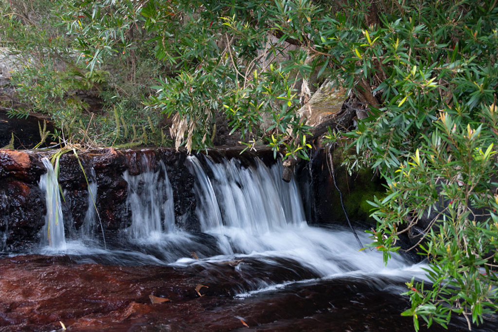
Curracurrang Cove to Curracurrong Falls
From the cove, continue following the track south. Soon the trail starts to climb a headland, but it is a gentle climb, nothing like the near-vertical ascent from Garie Beach. You won’t know when you have reached Eagle Rock, because it is not visible from the trail. You are walking at the same level as the top of Eagle Rock.
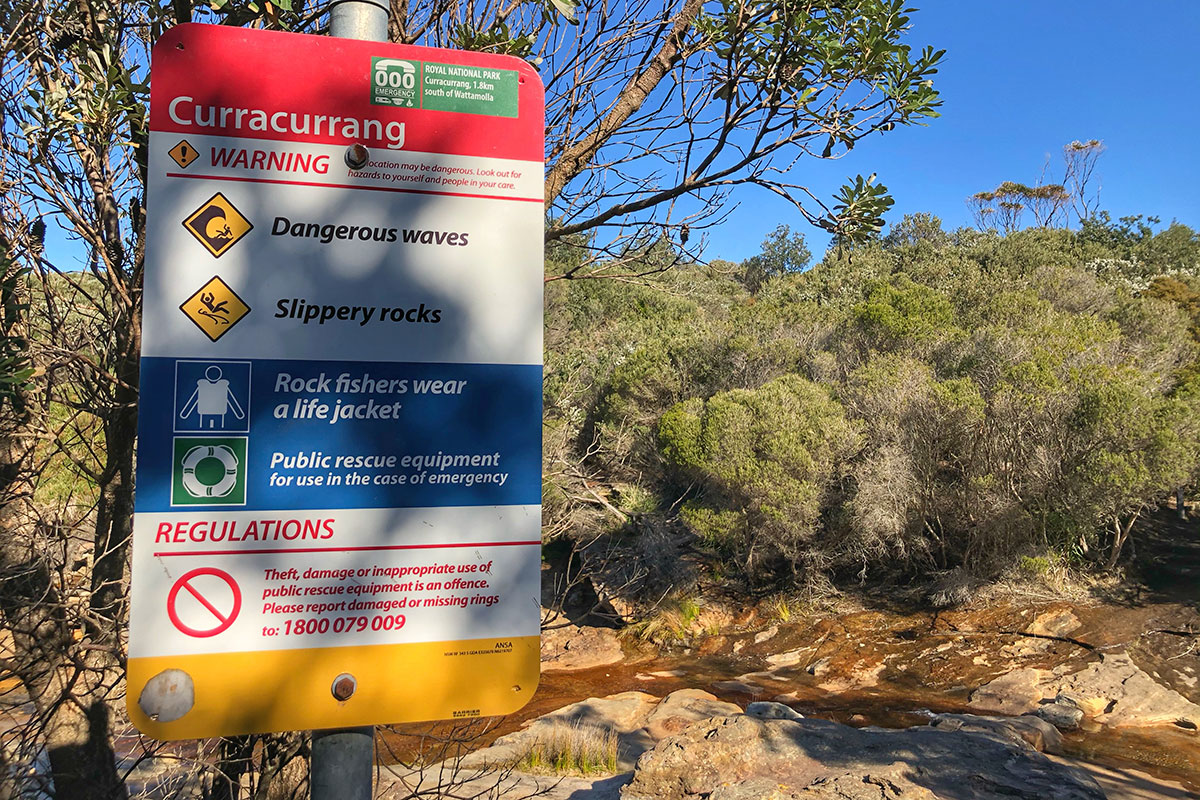
You will know that you have arrived when you reach Curracurrong creek – it runs across the headland and feeds Curracurrong falls. This creek is broader than Curracurrang cove creek (confusing, I know!). For comparison sake, Curracurrang cove creek that you reach first walking from Wattamolla is signposted and has only a couple stepping stones, while Curracurrong creek is unsignposted and has 9 stepping stones across.
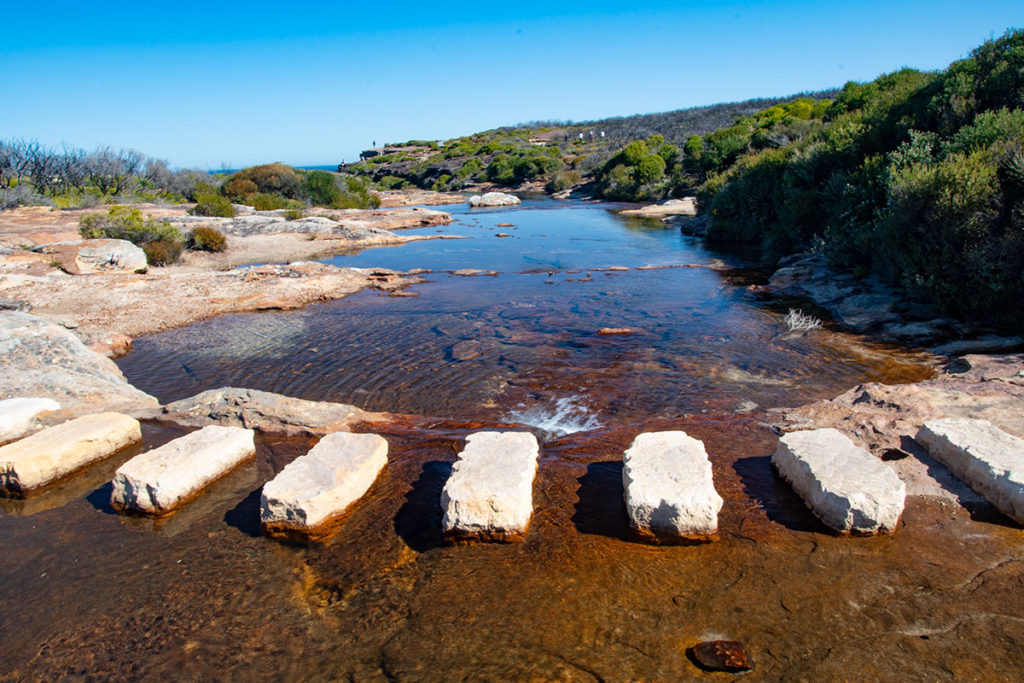
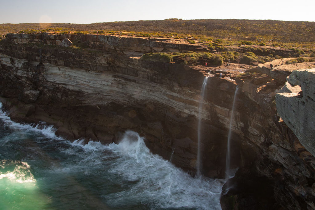
So, once you reach a creek with 9 stepping stones across, you have arrived at Curracurrong Falls. If you are visiting on a weekend, that’s where all the people will be!
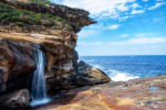
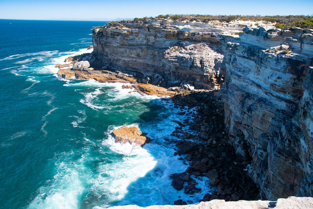
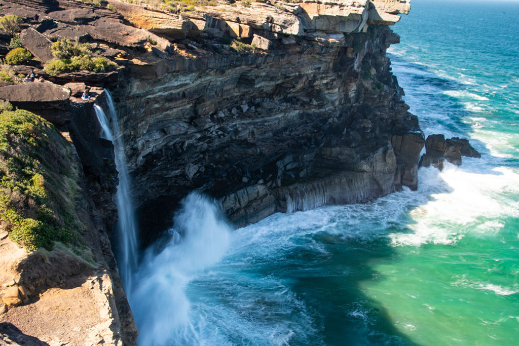
The falls can only be seen from the edge of the cliff on either side, so make sure you are taking care when approaching the edge of a 100-meter-high cliff.
One of the best vantage points for the falls is the top of Eagle Rock – a famous rock formation that looks like… you guessed it – the head of an eagle. There is an unsignposted trail leading to the rock from the main track, just before you reach Curracurrong creek. Another good viewpoint is on the other side of the creek, along the cliff tops.
You could also get quite an interesting perspective from the top of the falls looking down. Walk along Curracurrong creek to the edge of the cliff and if you are not prone to vertigo lie on your stomach and watch the water plumet 82 meters to the ocean.
What next
You have a couple of choices for the second leg of your hike. You could return to Wattamolla by re-tracing your steps. Or you could continue to Garie Beach, the distance is the same in either direction. With a bit of planning, you could time your walk to arrive at Garie beach in time for the shuttle pick up that would take you back to Wattamolla or to Sutherland station (more details on the shuttle below).
How to get to Wattamolla
There is no public transport to Wattamolla. But you can catch a private shuttle from Sutherland if you are catching the train.
Drive: Wattamolla is just under 50km from Sydney CBD and the drive takes just over an hour. There are two car parks at Wattamolla, although during the summer months it fills up quickly. There is a $12 fee to enter the National Park that you will pay on the drive down.
Shuttle: If you prefer not to drive, Park Connections offers a shuttle service between Sutherland Station and Wattamolla, as well as other destinations in Royal National Park.
More Nature Adventures in Royal National Park
- Werrong Beach – the best-kept secret in Royal National Park

- Karloo Pools and Uloola Falls – A beautiful walk in Royal National Park
- Secret swimming hole on Kangaroo Creek, Royal National Park
- Birds and Waterfalls of Curra Moors Loop Track in Royal National Park
- Lady Carrington Drive Walk: rainforest and lyrebirds
- Hidden Gems on Bundeena to Marley Beach Walk
- Forest Path in Royal National Park – a Tranquil Rainforest Track
- Bulgo Beach – a unique fishing shack village in Sydney
- Garawarra Farm Carpark to Burning Palms Beach Track
- Wattamolla to Curracurrong Falls Walk, Including a Tranquil Hidden Gem